How are predictive policing and traffic management tools used on Indian roads? | Explained Premium
The Hindu
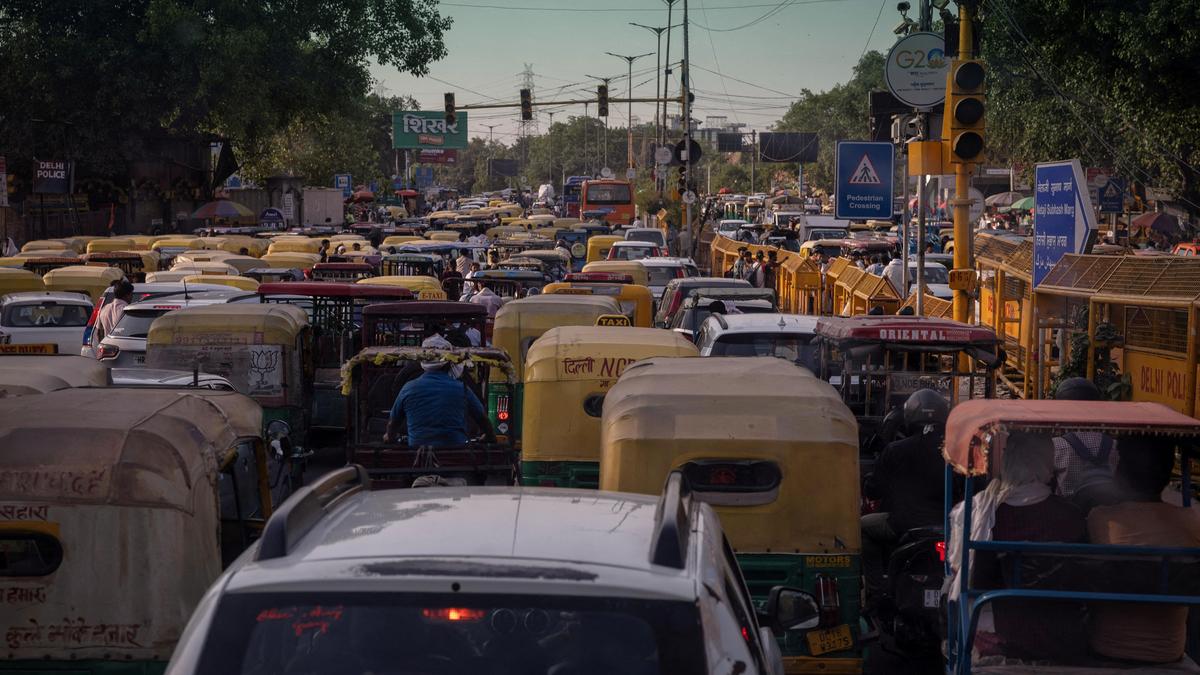
Intelligent traffic policing systems in India allow the authorities to quickly process data in order to get a consolidated picture of which areas require immediate intervention
The story so far: On February 20, Dick Schoof, former Prime Minister of the Netherlands, visited Bengaluru Traffic Police’s Traffic Management Centre (TMC), where he spoke about the Actionable Intelligence for Sustainable Transformation Management (ASTraM) system. ASTraM, developed in collaboration with the Dutch company Arcadis, pools data from CCTV footage and open data sources to monitor and predict trends in real-time across Bengaluru’s congested roadways. Cities like Delhi, Hyderabad, and even Dubai, have expressed interest in this technology, a source said.
Google Maps and other prominent mapping applications have been providing users with real-time traffic congestion data for years. They also report on traffic incidents and affected regions. But these systems do not provide predictive services. In contrast, ASTraM identifies congested areas, batches them, and then alerts relevant officers at fifteen minute intervals. By capturing both recurring and non-recurring congestion points, this application provides insights that can be used for predictive traffic policing and incident reporting.
Automatic number plate recognition (ANPR) is another strategy that is used across Indian cities to identify violators. The Greater Chennai Traffic Police also uses an integrated traffic regulation system (ITRS) that involves AI and live feeds for efficient traffic management, allowing them to track down repeat offenders.
Intelligent traffic policing systems allow the authorities to quickly process data across many media formats in order to get a consolidated picture of which areas require immediate intervention and urgent traffic policing solutions. The police can also build on this data to prepare for future events like processions, unrest, and traffic chokeholds. This is far more effective than relying on existing app-based GPS systems, or waiting for users to telephone or post their complaints on social media before taking action.
Furthermore, since these intelligent traffic policing systems have more localised data to work with, they can potentially prevent accidents that occur due to a mixture of Google Maps and human errors. For instance, take past incidents where Google Maps allegedly led drivers into dangerous zones such as non-functional bridges, causing multiple deaths.
Surveillance/intelligence policing can also help the authorities identify rule violators in risky areas, without officers having to be physically present at the scene.

Niranjanaradhya highlights Gandhi's vision of life skills-based education and critiques the neglect of government schools in India.

Leader of Opposition R. Ashok on Tuesday alleged in the Legislative Assembly that the ruling Congress government is planning to shut down Bengaluru’s only Government Flying Training School (GFTS) at Jakkur to develop an exclusive club for MPs, legislators, and senior bureaucrats.

The highlight of every edition of the Whitefield Art Collective is the Kala Car, an exhibit that showcases the creative and artistic prowess of art students. Over the years, this clever play on words has titled vehicles that have either been rescued from the scrap yard or sponsored or auctioned or all of the above.

Devotees flock to Sri Kanaka Durga Temple for serene Pushparchana celebrations during Vasantha Navaratri, adorned with fragrant floral decorations.

CAG audit reveals Arvind Kejriwal's bungalow renovation exceeded budget by 342%, costing ₹33.66 crore instead of ₹7.91 crore.

Unexpected hailstorm and evening showers in Hyderabad catch commuters off guard on March 24, 2026 evening, providing relief from the intense afternoon heat.

EVMs and VVPAT units dispatched to Erode's eight Assembly constituencies ahead of polling on April 23, 2026.

Indigo Airlines may halt Bengaluru–Shivamogga flights; MP Raghavendra seeks to persuade the airline to continue services.

181 offenders held in month-long crackdown on harassment

39 enforcement officials in Hyderabad trained to enhance road safety measures in school zones for better child protection.

Hyderabad bucks congestion trend as traffic speeds improve despite a surge in vehicles on its roads.

‘Love Mocktail 3’, the latest installment of the hit Kannada franchise from Darling Krishna-Milana Nagaraj, is winning hearts in Karnataka, weathering the challenge of the action-packed juggernaut ‘Dhurandhar: The Revenge’

VSU professor R. Madhumathi awarded by Venus International Foundation for her exceptional contributions to education and social service.