Study maps future glacial lakes Premium
The Hindu
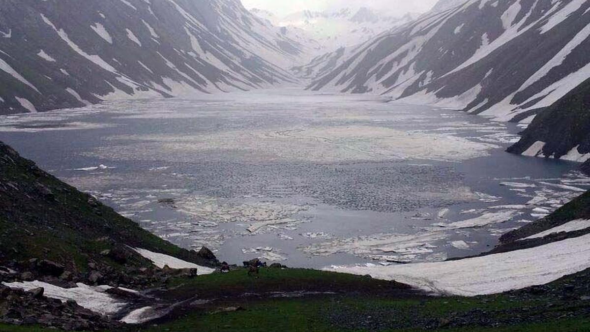
IIT Guwahati researchers identify 493 high-risk sites for future glacial lakes in the Eastern Himalayas to enhance disaster preparedness.
GUWAHATI: A team of researchers from the Indian Institute of Technology Guwahati (IIT-G) has developed a new way to identify where glacial lakes are likely to form in the Himalayas, offering a potential breakthrough in disaster preparedness for mountain regions facing rapid climate change.
Their study focuses on the Eastern Himalayas, which has recorded the highest frequency of glacial lake outburst floods, or GLOFs, in the entire mountain range. These sudden floods occur when natural dams holding back glacial lakes collapse, releasing vast volumes of water, debris and sediment downstream.
The findings of this research have been published in Nature Scientific Reports journal. The paper has been co-authored by Ajay Dashora of IIT-G’s Department of Civil Engineering, along with his research scholar Anushka Vashistha and Afroz Ahmad Shah of the Universiti of Brunei Darussalam.
GLOFs have caused extensive loss of life and damage to infrastructure in the past, including roads, bridges, hydropower projects, and agricultural land. The last major disaster caused by a GLOF was in October 2023 in Sikkim, which killed 94 people, damaged 1,835 houses, displaced 2,563 people, and swept a 1,200-megawatt dam away.
According to the researchers, the number and size of glacial lakes are increasing as glaciers retreat faster due to rising temperatures, heightening the risk to downstream communities.
While earlier studies largely relied on climate data to assess glacial lake hazards, the new research takes a different approach. It places geomorphology—the physical shape and structure of the land—at the centre of prediction.

Anna University partners with Ramco Systems to create an advanced ERP lab for enhanced industrial engineering education.

NDA announces candidates for 12 Kozhikode seats in Kerala Assembly polls 2026 as UDF and LDF ramp up campaigning.

As India formulates its next steps in the Israel-U.S.-Iran war, it is necessary to consider not only what it will mean for the whole region but also its own ties with each neighbour

CITU criticizes the Centre's privatization efforts for VSP, alleging employee removal over production increase and financial mismanagement.

Visakhapatnam Customs House's short film "Right Turn" wins Honourable Jury Mention at the 10th Indian World Film Festival.

Economist Arvind Subramanian advises CM Revanth Reddy on strengthening Telangana's finances during a meeting in Hyderabad.

Supreme Court emphasizes stakeholder consultation for legal education reforms, hesitant to change five-year law course duration.

Authorities in Andhra Pradesh are set to tranquillise a roaming tiger near Annavaram temple for safety and conservation.

MEA criticizes USCIRF for bias, urging focus on vandalism of Hindu temples in the U.S. over selective criticism of India.

Bengaluru's Urban Development aims to beautify underutilized flyover spaces, enhancing city aesthetics and improving green cover initiatives.

Indian Navy warships escort merchant vessels in the Gulf of Oman, ensuring safe passage amid regional tensions under Operation Sankalp.

A rare crab species exhibiting both male and female traits was discovered in Silent Valley, revealing unique biological characteristics.

Gujarat court convicts five in 2016 Una flogging case; punishment announcement scheduled for March 17, 2026.