Up to 10 cm of snow possible on Sunday as cold front moves through Waterloo region and area
CBC
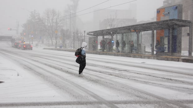
Dig out the shovels and the tuques because up to 10 cm of snow is possible in Waterloo region, Guelph and Wellington County on Sunday.
A special weather statement issued by Environment Canada on Friday said a low pressure system may bring significant snowfall to the area.
"Confidence remains low with respect to the strength and track of this weather system, and as such the areas affected and snowfall amounts may change," the statement notes.
Snow is expected to start falling Sunday morning and continue throughout the day.
People should be prepared, Environment Canada says, and motorists should be prepared to change their driving behaviours to match the conditions.
"Adjust travel plans accordingly. Poor weather conditions may contribute to transportation delays," the statement said. "Installation of winter tires should be considered prior to Sunday."
The forecast for Saturday said it was expected to be a mix of sun and cloud with a high of 4 C.
Sunday is cloudy and snowy with a high of 1 C.
Monday is a mix of sun and cloud with 60 per cent chance of flurries and a high of 0 C.

Eight casinos across southwest B.C. have been sold to First Nations in the last two years, with the province's gambling scene set to be reshaped as a result.

Hamilton hosts the Junos Sunday, and the musical awards show is bringing tourists, musicians, concerts and a ton of themed events to the city this week.

The multi-million-dollar deal at the heart of a high-profile fight between the Canadian government and one of the world’s biggest carmakers contains multiple clauses about the company’s footprint in Ontario, according to a copy obtained by CBC Windsor.

In recent months, Calgary police have carried out three day-long safety blitzes, parading out dozens of officers to flood an area with their increased presence — at least, temporarily.

A national organization is seeking people with experience in Canada's forestry sector as they put together a working group that will examine ways to improve forest recovery following wildfires.

Ella Heyder is bracing for a breakup, even though she already moved out decades ago.

Shawne Hopkins never saw it coming.

Politicians return to Queen’s Park Monday for a shortened spring session, as Premier Doug Ford prepares to unveil his eight budget amid heightened global economic uncertainty.

Despite a recent announcement that a water supply pipeline will be build in Oneida Nation of the Thames, some members of the community say that's no excuse for taking water for granted.

As scandal has swirled around former prince Andrew Mountbatten-Windsor, questions and curiosity have also focused on his ex-wife, Sarah Ferguson, and their daughters, Princesses Beatrice and Eugenie.

Friday may have been the first day of spring, but winter storms are not over yet for Newfoundland.

While we officially welcomed spring last week, an incoming system will be a reminder that snow is still very much part of the new season, especially early on.

The future of a national historic site in Fredericton is up for discussion at meetings across New Brunswick in the next few weeks as the Anglican diocese considers what to do about costly repairs needed at Christ Church Cathedral.