Roughly half of the Mantario Trail has been torched by wildfire. Now what?
CBC
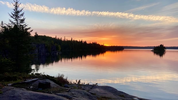
One of the casualties of the 2025 wildfire season is Manitoba's most popular distance-hiking route, which is closed indefinitely due to a fire that's swept across the wilderness zone in Whiteshell Provincial Park.
Roughly half of the 63-kilometre Mantario Trail lies within the perimeter of the fire known as EA063, which began near Ingolf, Ont., in mid-May before spreading into Manitoba's Whiteshell area. It has engulfed more than 5,400 hectares (54 square kilometres) of boreal forest in Manitoba, plus an adjoining swath of Ontario.
While the fire is being held, it remains an active blaze. Provincial crews have yet to assess the condition of the trail or the campsites that lie within the boundaries of the fire at Caribou, Marion, Olive, Moosehead and Mantario lakes.
"We recognize that it has been significantly impacted," said Mike Moyes, Manitoba's minister of the environment and climate change. "Our team is looking forward — once the risk is lowered for us — to get in there."
While more than 30 kilometres of the Mantario lies within the fire perimeter, it's unclear how much of the trail has actually burned. Wildfires sometimes pass over low-lying areas or spare rocky outcrops at higher elevations.
Regardless, the province has already warned backpackers and trail runners who may have had plans to visit the trail this year to make other arrangements. This is not just because deadfall must be cleared from campsites and the trail itself.
Maintenance crews may have to bring down thousands of widowmakers — the dead trunks of burned trees left standing but highly prone to falling during windstorms — before the trail can be deemed safe enough to traverse.
Even then, the trail may not make for a pleasant walk or run. While forests do regenerate, burned areas are devoid of shade and can be unpleasantly hot to traverse when a pack is on your back.
This will present a quandary for park officials, given the increasing popularity of outdoor recreation in a province without many distance-hiking options.
In recent years, the Mantario Trail has become immensely popular on its own. Two decades ago, it was possible to walk the Mantario during the optimal hiking season in September — when the trail is dry and biting insects are all but nonexistent — and only see a handful of other humans.
Since the start of the pandemic, which further fuelled the outdoor recreation boom, it has become commonplace to find 30 people or more at every campsite on the trail, making the Mantario feel more like a front-country music festival than a back-country wilderness destination.
Removing the Mantario Trail from the available distance-hiking options, even if the southernmost and northernmost sections do reopen, will only place more usage pressure on Manitoba's other distance trails, such as the 42-kilometre Epinette Creek-Newfoundland trail system in Spruce Woods Provincial Park, the 39-kilometre Tilson Lake loop in Riding Mountain National Park and the 29-kilometre Upper Track Trail in northern Manitoba, which connects Pisew Falls with Kwasitchewan Falls.
One option facing Whiteshell administrators and volunteers could be a temporary rerouting of the Mantario Trail to the west while the fire-impacted area recovers. This may not prove popular with cottagers at Florence Lake, who successfully lobbied decades ago to move the trail to the east.
A second option would involve fast-tracking the creation of new trails. Very few new hiking trails have been created in Manitoba since the 1970s, and certainly none since the popularity of hiking and trail running exploded.

The government of Saskatchewan has announced plans to reduce the length of non-resident game bird hunting licences to combat illegal guiding.

An 87-year-old Alberta man is fighting extradition to the United Kingdom to stand trial for historical allegations of physical and sexual assault involving minors.

Eight casinos across southwest B.C. have been sold to First Nations in the last two years, with the province's gambling scene set to be reshaped as a result.

Hamilton hosts the Junos Sunday, and the musical awards show is bringing tourists, musicians, concerts and a ton of themed events to the city this week.

The multi-million-dollar deal at the heart of a high-profile fight between the Canadian government and one of the world’s biggest carmakers contains multiple clauses about the company’s footprint in Ontario, according to a copy obtained by CBC Windsor.

In recent months, Calgary police have carried out three day-long safety blitzes, parading out dozens of officers to flood an area with their increased presence — at least, temporarily.

A national organization is seeking people with experience in Canada's forestry sector as they put together a working group that will examine ways to improve forest recovery following wildfires.

Ella Heyder is bracing for a breakup, even though she already moved out decades ago.

Shawne Hopkins never saw it coming.

Politicians return to Queen’s Park Monday for a shortened spring session, as Premier Doug Ford prepares to unveil his eight budget amid heightened global economic uncertainty.

Despite a recent announcement that a water supply pipeline will be build in Oneida Nation of the Thames, some members of the community say that's no excuse for taking water for granted.

As scandal has swirled around former prince Andrew Mountbatten-Windsor, questions and curiosity have also focused on his ex-wife, Sarah Ferguson, and their daughters, Princesses Beatrice and Eugenie.

Friday may have been the first day of spring, but winter storms are not over yet for Newfoundland.