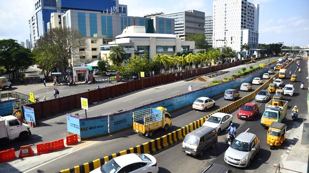
Urban sprawl causing warmer temperature in peri-urban areas
The Hindu
Shrinking waterbodies, green cover in Chennai Metropolitan Area is causing higher land surface temperature
The Chennai Metropolitan Area, predominantly an agricultural area in 1988, has nearly 48.7% of built-up area. The decadal changes in land use and urban sprawl has led to warmer temperature and increasing urban heat island effect spreading to peri-urban landscape.
This was one of the key findings of a study titled “Monitoring spatio-temporal dynamics of urban and peri-urban land transitions - A case study of Chennai Metropolitan Area” by the Centre for Water Resources, Anna University.
According to the study that covered an area of 1,189 sq. km., including parts of Kancheepuram and Tiruvallur districts, the CMA had a vegetation cover of nearly 17,770 hectares, which was 14.9% of the area in 1988. It has drastically shrunk to 7,288 hectares, which was only 6.1% of the area in 2017.
Similarly, waterbodies that occupied nearly 8,023 hectares, which was 6.7% of the area in 1988, has decreased to an extent of 5,569 hectares, 4.6% of the CMA.
While the extent of agricultural lands had reduced from 42.2% in 1988 to 19.2% in 2017, it has been replaced by urban built-up area. The rapid urbanisation, particularly along East Coast Road and Rajiv Gandhi Salai and GST Road, led to increase in built-up area to 48.7% in 2017 from just 17.7% in 1988. The urban settlements has become denser from just 21,122 hectares in 1988 to 57,839 hectares now, according to the study.
As peri-urban areas are developed denser urban sprawl, particularly in the last three decades, they are experiencing a warmer temperature due to urban heat island effect, said M. Krishnaveni, Professor (Water Resources) and Director of Institute for Ocean Management, who co-authored the study.

AIADMK faces perception challenges and electoral setbacks in Tamil Nadu, struggling to maintain its traditional stronghold and voter base.

K. Ashok appointed Executive Director of BHEL Tiruchi, succeeding S. Prabhakar after 36 years of experience in the company.

Garbage collection resumes in Bengaluru amid contractor disputes over payment delays and new waste segregation rules by BSWML.

Delhi High Court rules universities cannot restrict peaceful expression of dissent, emphasizing the importance of independent thought and discourse.

Mettur Dam's water level is at 82.83 feet, with an inflow of 384 cusecs and discharge of 800 cusecs.

Lebanon expels Iran's ambassador, declaring him persona non grata, while maintaining a Charge d'Affaires at the embassy.

Sunny Joseph accuses Pinarayi Vijayan of targeting Rahul Gandhi as part of a political deal with the BJP.

AIADMK faces perception challenges and electoral setbacks in Tamil Nadu, struggling to maintain its traditional stronghold and voter base.

Sunny Joseph accuses Pinarayi Vijayan of targeting Rahul Gandhi as part of a political deal with the BJP.

Mahesh Dattani and Jonathan Taikina Taylor collaborate play, ‘The Monk & The Warrior’, to be staged at Mumbai’s Experimental Theatre from April 2 to 5

NHAI's rooftop solar plants on three toll plazas generate 521 daily units, saving 1.87 lakh conventional power units annually.

Congress criticises PM Modi's Rajya Sabha statement on West Asia, calling it a "self-praise" prepared text without Opposition clarification

Kerala has 2.71 crore voters for the April 9 Assembly polls, with 2,040 polling stations marked as critical.