Heavy rains lash Chennai and surrounding areas as Cyclone Fengal moves closer to T.N. coast
The Hindu
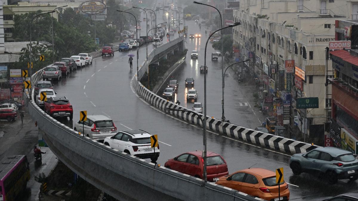
Cyclone Fengal, which is approaching the Tamil Nadu coast, has triggered heavy rainfall and strong winds over Chennai and its neighbouring districts since the early hours of Saturday (November 30, 2024).
Cyclone Fengal, which is approaching the Tamil Nadu coast, has triggered heavy rainfall and strong winds over Chennai and its neighbouring districts since the early hours of Saturday (November 30, 2024).
The Regional Meteorological Centre, Chennai, has maintained its red weather alert for Chennai, Tiruvallur, Chengalpattu, Kancheepuram, Villuppuram, Kallakurichi, Cuddalore districts, and Puducherry on Saturday.
Follow live updates here.
In its latest update, the RMC has said Cyclone Fengal is now expected to make landfall close to Puducherry by Saturday evening. The weather system has moved at a speed of 12 kmph over Southwest Bay of Bengal in the past six hours and lies over the same region as of 5.30 a.m. on Saturday, about 150 km east of Puducherry and 140 km southeast of Chennai.
It is likely to move nearly west-northwestwards and cross north Tamil Nadu-Puducherry coasts between Karaikal and Mahabalipuram, close to Puducherry, as a cyclonic storm with a wind speed of 70-80 kmph gusting to 90 kmph by Saturday evening.
The cyclone moving closer to the Tamil Nadu coast brought relentless downpour over many places in and around Chennai. The automatic weather station in Ennore recorded the heaviest rainfall of 13 cm during the past 24 hours ending 8.30 a.m. on Saturday, followed by Kathivakkam with 12 cm. Several other places in and around the city, including Tiruvottiyur, Tondiarpet, Sholinganallur, and Basin Bridge, received heavy rainfall of 9 cm each.
While downpour continues to pound Chennai and surrounding areas, other places like Tiruvannamalai, Ranipet, Tiruppur, Madurai, and Kodaikanal received light rains.

Lokpal cancels controversial tender for seven luxury BMW cars following public outcry and criticism from opposition parties.

Explore the pivotal events shaping Indian diplomacy in 2025, highlighting key visits and agreements.

Hyderabad Traffic Police relocate Ashoka tree to improve traffic flow at Trimulgherry bus stand while preserving green cover.

CBI court sentences four directors of D.N. International Ltd. to five years in prison for ₹5.75 crore bank fraud.

Maharashtra civic polls feature a debate between the Marathinama manifesto advocating for Marathi candidates and Congress's support for North Indians.

In 2025, BJP achieved significant electoral victories, ending AAP's reign in Delhi and boosting Nitish Kumar in Bihar.

Ancient Marathi literature reveals that Maharashtra's savannas, dating back 750 years, should not be classified as degraded forests.

A major fire gutted a plastic recycling unit in Thamarassery, Kerala, but no injuries were reported among workers.

Ajit Pawar announces NCP's seat-sharing talks with Shiv Sena for Pune and Pimpri-Chinchwad in Maharashtra's upcoming civic polls.

Fresh snowfall welcomes the New Year in Kashmir, attracting tourists to popular resorts amid unusual warm winter temperatures.

As Shah Rukh Khan makes a return after two years with the bloody actioner, King and Salman Khan wears the army uniform in Battle of Galwan, the year is set for a star-studded run at the box office

Bombay High Court prohibits BMC from using court staff for civic poll duty, citing constitutional authority and prior exemptions.

Opposition accuses Thane election officials of bias over rejected nomination papers for municipal elections amid allegations of favoritism.