Extreme cold, deep snow for Western Canada as East braces for ice, freezing rain
CTV
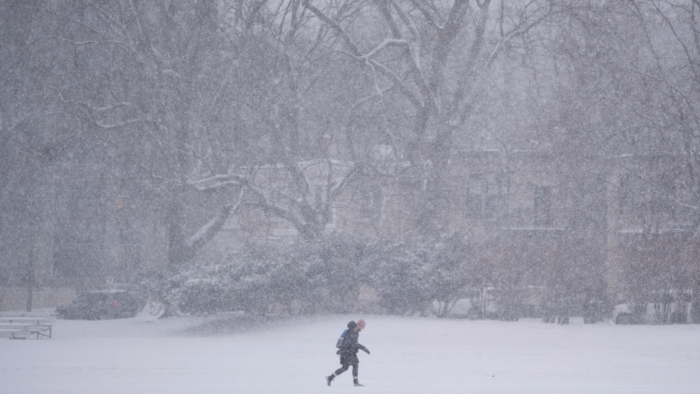
A Pacific frontal system is tapering off in Western Canada, as Ontario prepares for an Alberta Clipper to bring lots of snow ahead of ice and freezing rain from an incoming Colorado low.
Most of Canada is under warnings from Environment Canada on Tuesday, principally due to two weather systems.
A messy winter snow and ice storm is heading toward Ontario, with most of the Prairies and northern parts of Canada under extreme cold and winter storm warnings.
A double-barreled storm, fuelled by an "Alberta Clipper" and then a "Colorado low," is expected to bring high ice accumulation totals to the southern half of Ontario and higher snow totals to the northeast.
The Alberta Clipper, a low-pressure storm system that moves from the west, will impact northern Ontario communities overnight on Tuesday.
The system from Colorado brings low-pressure Wednesday evening, to the southern half of the province with snow and freezing rain expected.
As the two systems head to Eastern Canada, many provinces including B.C. and the Prairies are buried under snow and subject to extreme cold warnings issued by Environment Canada.
Parts of northern Ontario are under extreme cold warnings, including areas such as Attawapiskat, Fort Severn and Sioux Lookout, where the temperature is expected to feel like -40 degrees Celsius with wind chill.

The teacher who sprang into action after a 15 year old student was set on fire by another student at Evan Hardy Collegiate has been awarded the Carnegie Medal for Heroism.

Former Alberta premier Jason Kenney is taking up the Canadian cause as he’s set to participate in two debates about separatism against a lawyer pushing for the province to go its own way.

Domestic violence survivors in Alberta will soon have access to a mobile app designed to provide real-time alerts if an offender with an ankle monitor breaches a court-ordered boundary.

As police continue to search for a gunman after a deadly shooting in an Abbotsford homeless camp this week, there are mounting questions about why so many camps exist in that community, including one that was supposed to have been shut down months ago.

It’s been two months since James Van Veen was last seen alive. After bad weather scuttled searches in January, the Grey County OPP resumed the ground search for the missing Grey County man on Wednesday.

A First Nations group is calling on the federal auditor general to investigate the Canadian Human Rights Commission, arguing its delay in hearing a case about funding for on-reserve fire services is resulting in unnecessary death.

Ontario’s education minister defended a letter he sent to school boards this week, calling for graduation ceremonies to be 'strictly student-centred, apolitical, inclusive and respectful.'

The final four Alberta recall petitions aimed at unseating United Conservative members of the legislature have failed.

Premier Danielle Smith says she has nothing to hide when it comes to the province’s health procurement controversy.

The Moose Jaw & District Food Bank is being pushed to reduce its services due to ongoing food supply constraints.

An early-morning fire Wednesday destroyed several vehicles and an office at a used car dealership in Saskatoon.

A Winnipeg councillor has been charged after allegedly drugging and sexually assaulting a man last year.

John Maloney, who was approved for medical assistance in dying last month, knows exactly which song he intends to listen to when he dies on Friday.