El Niño is almost over. A similar phenomenon may be next. What is La Niña?
Global News
Meteorologist are watching for a weather pattern called La Niña, the opposite of the El Niño pattern behind this year's warm winter. La Niña could bring storms or even hurricanes.
Winter in Canada has been warmer than usual thanks to El Niño, but there’s a chance the weather event could be followed by a chilly La Niña this year, experts say.
While El Niño is characterized by warm, above-average sea-surface temperatures, La Niña is a climate pattern that tends to occur soon after El Niño and brings on opposite, cold effects.
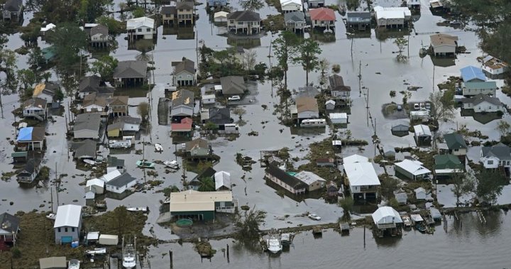
Weather events that cause changes in sea temperatures can have widespread impacts, which is why meteorologists closely monitor them. In the case of La Niña, greater precipitation and winds may lead to rain storms, or even hurricanes.
If La Niña does occur in 2024, meteorologists say it would begin in late summer or early fall.
La Niña is a climate phenomenon that results in cooler-than-normal waters appearing off the coast of South America, near Ecuador and Peru.
The weather anomaly occurs when stronger trade winds push warm water away from South America and toward Australia and Indonesia across the equatorial Pacific Ocean, which leaves a buildup (or upwelling) of cold water. That results in cooler air over the west coast of North America, and drier air in the southern United States.
Canada has had strong El Niño weather patterns in the past, which is believed to have factored into warm winters, Global News meteorologist Ross Hull says. While La Niña tends to bring colder winters, Hull says a stronger signal can also lead to bigger storms or hurricanes in Canada.
Sea temperatures are still warmer than usual and will likely remain that way through the spring, so a La Niña event wouldn’t happen right away, Hull says.

Tensions flared as CAQ leadership rivals clashed over Quebec’s “third link” project in the first debate to replace Premier François Legault.

Toronto police have charged a 60-year-old man with second-degree murder in connection with the death of Xian Wei Shao, whose remains were discovered in a north end home last week.

Finance Minister François-Philippe Champagne says the government has found ways to cut spending by $60 billion but cautions that published spending cuts require important context.

Three Canadians from Quebec who were stranded in the Persian Gulf since Feb. 28 have returned home following a coordinated repatriation effort.

Federal departments announced that they plan to cut more than 12,000 jobs over three years as part of the Carney government’s spending review plan.

Canada’s Integrated Threat Assessment Centre says the U.S.-Israeli war against Iran has heightened an already present threat against Jewish Canadians and public officials.

Edward Warner, his wife Tania and his seven-year-old step-daughter Ayla were coming back from a friend's baby shower on Saturday when they went through an ICE checkpoint in Sarita.

A fire chief from a village that battled flames during Saskatchewan's destructive wildfire season last year says the province's latest budget does not provide enough funding.

Manitoba’s upcoming budget will include more child care funding and a smaller deficit, as the NDP government aims to balance finances by 2027.

A member of the Royal Canadian Air Force in Winnipeg has just been crowned the World's Strongest Firefighter, outlifting athletes from around the world.

Muslims across Canada are celebrating Eid al-Fitr while some reflect on conflict affecting loved ones abroad, as leaders highlight unity, charity and renewal.

The Iran war has raised the price of crude oil beyond US$110 per barrel in international markets, spurring affordability concerns in Canada and around the world.

The statement from Global Affairs Canada comes a day after U.S. intelligence leaders unanimously testified that reports denying foreign involvement should be retracted.